Below, an aerial via of Ur of the Chaldees (Arabic Tell al Muqayyar, in southern Iraq, according to some scholars). Note how barren and arid the landscape is without the life-giving waters of the Euphrates which has moved away over the centuires denying its waters to the once irrigated fields about the city. (for the photo cf. p. 59. Barthel Hrouda. Editor. Der Alte Orient, Geschichte und Kultur des alten Vorderasien. C. Bertelsmann. Verlag GmbH/54321. Munchen. 1991. ISBN 3572=00867-0)
Below, another view of Ur of the Chaldees, showing the great plain (called edin in Sumerian) in the distance (for photo, cf. p. 62. Barthel Hrouda. Editor. Der Alte Orient, Geschichte und Kultur des alten Vorderasien. C. Bertelsmann. Verlag GmbH/54321. Munchen. 1991. ISBN 3572=00867-0)
Below, a map of Ur of the Chaldees, modern Tell al-Muqayyar, understood by some scholars to have been the home of Terah and his son Abraham (Ge 11:31). Note the "temple of the god Enki" at number 10 on the below drawing. I understand that several motifs found in Genesis, the creation of a naked man to tend a god's garden, and the confusion of one language into a babel of many languages, as well as the sending of Flood, are all Hebrew transformations of feats attributed in large part by the Mesopotamians to their god Enki who's main shrine or temple was at nearby Eridu. For the Hebrews the world began at Eden in a garden of a God; for the Sumerians, the world began at the city of Eridu, created by Enki, who, in conflicting myths, later made a naked man to roam edin (Sumerian: plain or steppe) with wild animals for companions and who later had him tend and till his fruit tree garden which Enki had planted next to his Eridu shrine. Please click here for my article identifying eden with Eridu in edin the floodplain of Sumer (For the below map cf. p. 16. "Plan of the city of Ur." Werner Keller. The Bible As History, Archaeologists Show the Truth of the Old Testament. Oxford, England. A Lion Book. Lion Publishing House. 1991. ISBN 073240562)
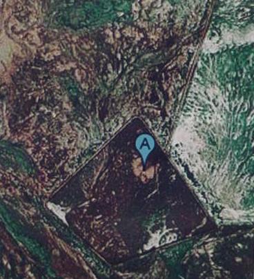
Below, a satellite image showing the mound called Tell al Muqqayar "the mound of pitch" in Arabic. It is the small brownish oval at the top center of the photo. What has riveted my attention however is what appears to my "untrained eye" as a great rectangular "buried" city south of and adjacent to Tell al Muqqar. Was the Muqqayar the acropolis or "upper city" and the "lower city" the rectangular site to its south? Today a runway for airplanes sits atop the buried "lower city" of Ur.
Leick understood that Eridu and Ur were "twin cities," the kings of Ur rebuilt the holy Abzu shrine at Tell Abu Shahrein (ancient Eridu) in Ur III times (the 3rd millennium B.C.). Their names appear on the bricks at Eridu's Ziggurat.
Below, "my" drawing based on satellite images of Ur and Eridu, showing a great canal connecting the two cities. The satellite also reveals that just as Ur had a great rectangular city south of Tell Muqqayar, so too, Tell Abu Sharein (Eridu Ziggurat) is associated with a huge "lower city" within the trapzoidal walls, perhaps a canal-moat-wall? Archaeologists have identified seven tells at Eridu. My studies of the great trapzoidal wall of Eridu shows numerous canals criss-crossing the site within the walls.
Below, a satellite image of Eridu's great trapzoidal wall and the canal from ancient Ur which penetrates the wall stopping just east of the Eridu Ziggurat (Tell Abu Shahrein). Please click here for my article on Eridu being one of the principal sites for the pre-biblical Garden of Eden and its satellite images and maps.
27 April 2009 Special Update:
I have been informed by Dr. Collins that I am in error. Ur's and Eridu's walls appearing in the above sattelite images are not ancient, they are modern. My thanks to Dr. Collins for this correction and my thanks to the British Museum (London) for putting me in contact with him:
20 April 2009
Dear Mr. Mattfeld,
Thank you for your email which has been forwarded to me from the Information Service.
I was very interested to read your suggested identifications for features visible on Google Earth in the area of ancient Eridu. As you know, the reading of satellite images is extremely difficult and I am glad you have been in contact with Dr. Elizabeth Stone who is an expert in this field - indeed, her work on the recent survey was invaluable to us. I am not an expert in satellite imagery myself but I can say from my experience on the survey that the areas surrounding these ancient sites were covered with modern roadways and military constructions - there was clear evidence of military activity around the mounds of Eridu with burnt-out vehicles and oil drums. Major roads were constructed in the region, especially during the Iraq-Iran conflict; these are built on raised levies and this might give the impression in a satellite image of a fosse-ditch. The mounds of Eridu have been extensively surveyed, both at the time of excavation and more recently, including the use of aerial photography (there are photographs of ancient sites made by the RAF as early as the 1930s) and there is no evidence for an ancient wall around the site. One feature in a Google Earth image in your report which I can positively identify is the US military airbase at Talil, next to the site of Ur. This is the large, rectangular feature beside the mound of Ur which you have suggested may be the 'down-town' area of the ancient site - alas, it is a huge modern creation, built around a smaller airbase which was already there in the 1930s. I would also suggest that the image posted on Google Earth showing the sun and water was not taken at Eridu as there has been no extensive water close to the site in modern times.
I am sorry I cannot be more precise with the dating of these satellite features but I believe most of them to be modern.